


Press release
23/04/2020
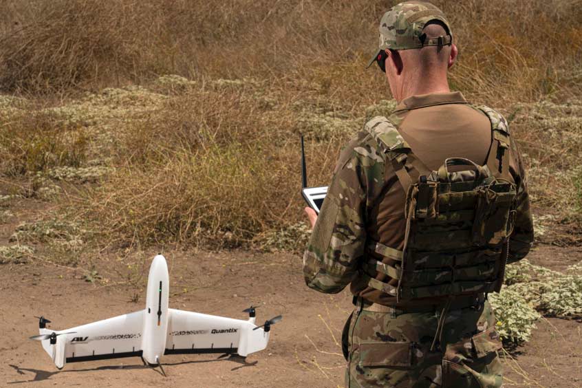
AeroVironment, Inc., a global leader in unmanned aircraft systems (UAS), today announced the availability of Quantix Recon, a lightweight, rapidly deployable, fully-automated reconnaissance solution that delivers high resolution, georeferenced terrain, vegetation and infrastructure imagery, providing ground forces with on-demand actionable intelligence.
With its unique hybrid VTOL design, Quantix Recon combines the vertical takeoff and landing advantages of a multirotor drone with the range, speed and efficiency of a fixed-wing unmanned aircraft. Featuring fully-automated flight operation, Quantix Recon surveys up to 1.6 square kilometers (0.6 square miles), or 20 linear kilometers (12.4 miles) per 45-minute single battery flight. Multiple automated reconnaissance mode options allow users to choose between line (route), area and waypoint targeted data capture. Collected aerial imagery data is compatible with a wide range of available geographic information system (GIS) analytical tools to facilitate further analysis.
"AeroVironment's Quantix Recon is a low-cost reconnaissance solution that can be in the air within minutes, capturing high-resolution georeferenced imagery of hard to access areas or dynamically changing environments." said Rick Pedigo, vice president of sales and business development for AeroVironment. "Because it does not rely on radio signals during flight, Quantix Recon offers greater stealth for concealed operations and is unaffected by radio frequency jammers, providing greater protection for frontline troops while reducing cognitive load."
Powerfully simple to use, Quantix Recon is fully-automated and hands-free with five optional flight altitudes, ranging from 150 feet to 800 feet. Simple, automated operation makes Quantix Recon easy for users to vary the coverage area and image resolution to suit their aerial reconnaissance needs.
Quantix Recon is equipped with dual 18-megapixel cameras that can capture both high resolution true color and multispectral georeferenced imagery. Powerful, on-board processing allows users to immediately view the high-resolution geospatial imagery on the included operating tablet as soon as the aircraft lands, requiring no other devices, internet or software. And, through the operating tablet's Quick-Look HD app feature, users can pinch and zoom navigation down to centimeter-level ground sampling distance, enabling them to pinpoint and react to critical issues with precision and speed.