
Press release
29/02/2024
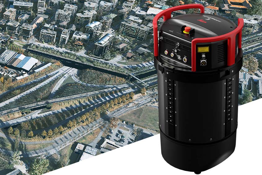
Leica Geosystems, part of Hexagon, introduces the Leica TerrainMapper-3 airborne LiDAR sensor, featuring new scan pattern configurability to support the widest variety of applications and requirements in a single system.
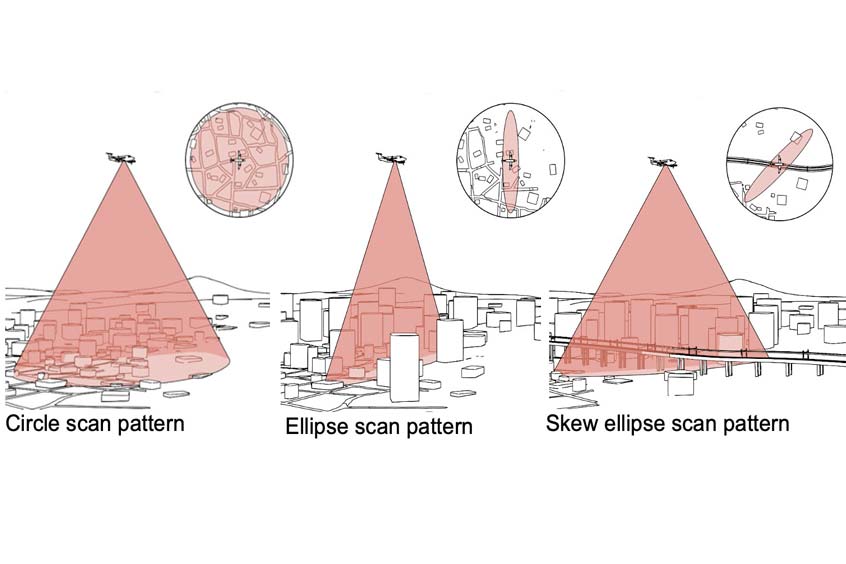
Building upon Leica Geosystems’ legacy of LiDAR efficiency, the TerrainMapper-3 provides three scan patterns for superior productivity and to customise the sensor’s performance to specific applications. Circle scan patterns enhance 3D modelling of urban areas or steep terrains, while ellipse scan patterns optimise data capture for more traditional mapping applications. Skew ellipse scan patterns improve point density for infrastructures and corridor mapping applications.
The sensor’s higher scan rate allows customers to fly the aircraft faster while maintaining the highest data quality, and the 60-degrees adjustable field of view maximises data collection with fewer flight lines. The TerrainMapper-3 is further complemented by the Leica MFC150 4-band camera, operating with the same 60-degree field of view coverage as the LiDAR for exact data consistency.
Thanks to reduced beam divergence, the TerrainMapper-3 provides improved planimetric accuracy, while new MPiA (Multiple Pulses in Air) handling guarantees more consistent data acquisition, even in steep terrain, providing users with unparalleled reliability and precision. The new system introduces possibilities for real-time full waveform recording at maximum pulse rate, opening new opportunities for advanced and automated point classification.
The TerrainMapper-3 seamlessly integrates with Leica HxMap end-to-end processing workflow, supporting users from mission planning to product generation to extract the greatest value from the collected data.
“We recognised the critical need for an efficient, fully configurable solution to support multiple LiDAR applications in a single system," said Layton Hobbs, Airborne Product Line Director at Leica Geosystems. "With its exceptional accuracy and versatility, and cutting-edge technology, the Leica TerrainMapper-3 opens up a world of possibilities and it's a game-changer for a data-driven future.”
Where we hold a LinkedIn profile it’s marked — the links come with a subscription.
Send releases and photographs to news@news.airframer.com — the pick of them reach Bulletin readers every Thursday.
The week’s aerospace manufacturing news, reported by our editors and delivered free to your inbox. Sign up ›
Subscribers see the confirmed supply chain behind every story — complete supplier lists for each aircraft program, sector and company. See the plans ›
Corrections go straight to the editorial team that maintains this directory.