PRESS RELEASE
Issued by: UAVOS Inc
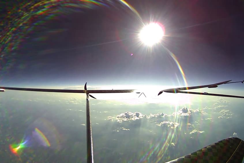
Photo: UAVOS
UAVOS and Mira Aerospace have completed a flight test of the NAVAI system, a vision-based navigation module designed to provide uninterrupted positioning for unmanned aircraft systems (UAS). Integrated into the ApusNeo18 high-altitude pseudo-satellite (HAPS), NAVAI maintained precise navigation under GNSS-denied conditions at an altitude of 16,000 metres (approximately 52,500 feet).
Traditional unmanned aircraft rely heavily on GNSS for positioning and navigation. When GNSS availability or accuracy is degraded by signal jamming, spoofing, or natural interference, NAVAI provides an alternative navigation capability by analysing video streams from onboard cameras and aircraft telemetry. While inertial navigation systems (INS) are widely used as a backup, they are subject to navigational drift, causing position errors to accumulate over time.
NAVAI addresses this challenge by combining visual odometry with terrain-referenced navigation. By matching real-time camera imagery with pre-loaded reference imagery, the module provides a bounded, non-drifting absolute position estimate whenever suitable terrain is visible. At high altitudes, where terrain features are sparse, NAVAI can obtain a position fix from a single frame.
NAVAI leverages advanced neural networks and onboard edge computing to process visual data in real time. Key technical features include:
– Neural network feature matching: The system identifies distinctive ground features and matches them with an onboard database of terrain maps to determine the aircraft's precise location.
– AI-Based noise filtering: Advanced algorithms compensate for visual disturbances such as cloud cover, haze, low-light conditions, and seasonal terrain changes, including snow cover and vegetation growth, to ensure reliable feature recognition.
– Ground Control Station (GCS) integration: A dedicated interface enables operators to view a live overlay of the aircraft's visual matches directly on the mission map.
"Testing NAVAI on the ApusNeo platform reflects our commitment to making UAS operations truly autonomous and resilient," said Aliaksei Stratsilatau, Founder and CEO of UAVOS. "By giving the aircraft the ability to 'see' and understand its surroundings, we are eliminating a critical dependency on satellite navigation, which has historically limited drone operations in contested and GNSS-denied environments."
| Contact details from our directory: | |
| UAVOS Inc | Automatic Flight Control Systems, Servoactuators, Autopilots, Airframer, Gimbal Systems, Whole Aircraft Parachutes, Industrial Ovens |
| Mira Aerospace | Airframer |
| Related aircraft programs: |
| Mira ApusNeo |
| Related directory sectors: |
| Flight & Data Management |

Weekly news by email:
See the latest Bulletin, and sign up free‑of‑charge for future editions.
H2-Sling hydrogen aircraft readies for flight
Heart’s X1 becomes largest battery-powered aircraft flown
North Wind commences build of hypersonic testing facility